


Garmin TOPO Mexico on microSD Card
$79.95
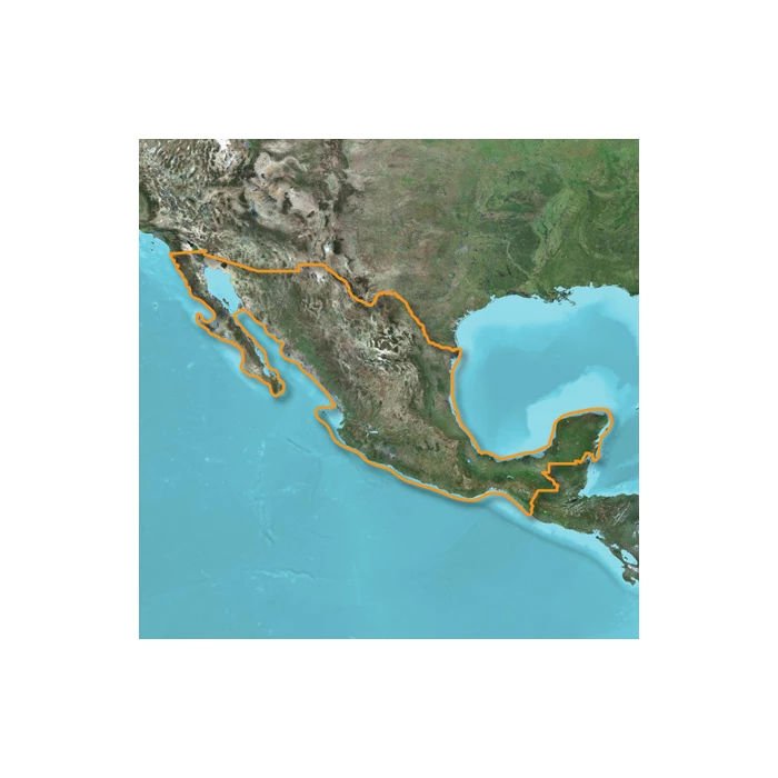
Let Garmin be your outdoor guide in Mexico. Whether you’re in the outback or on a main boulevard in the city.
Out of Stock (On Order)
Let Garmin be your outdoor guide in Mexico. Whether you’re in the outback or on a main boulevard in the city, our highly detailed maps provide a wide array of topographic information, from terrain contours, elevations and summits to perennial and intermittent lakes, rivers and streams.
Garmin Topo Mexico Features:
- Displays national and state park names as well as wilderness areas.
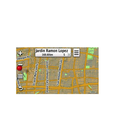
- Contains routable roads and trails so getting to your destination is easy.
- Includes searchable points of interests, such as campgrounds, geographic places, restaurants and more.
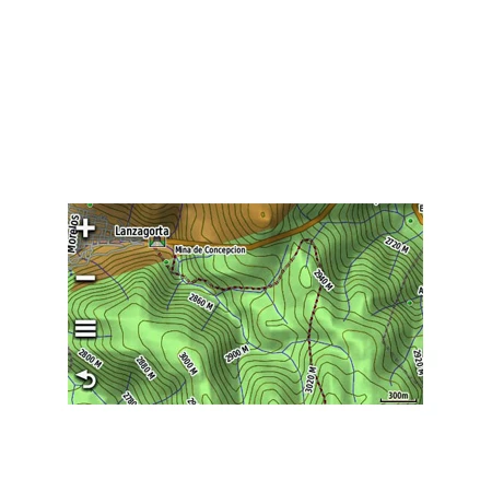
- Provides terrain contours, elevation information as well as summit peaks and geographic points.
- Contains hydrographic features, including perennial and seasonal lakes, rivers and streams.
- Offers 3-D terrain shading and elevation profile to help estimate terrain difficulty.
Compatible with these units: aera series; Colorado series; Oregon series; Montana series; Overlander; Dakota 20; GPSMAP 62s, 62sc, 62st, 62stc, 64sc, 64st, 64sx, 65, 65s, 66i, 66s, 66st, 78, 78s, 78sc, 79s, 79sc, 86i, 86s, 86sc, 86sci, 276Cx; GPSMAP 60Cx, 60CSx, 76Cx, 76CSx; GPSMAP 400/500 series; GPSMAP 700 series; eTrex ‘x’ series; eTrex 20, 20x, 22x, 30, 32x; Rino® 650, 655t, 750; Edge 605, 705, 800, 810; Astro® 320; echoMap 50s, 70s; nuvi series; dezl series; StreetPilot 7200, 7500; StreetPilot ‘c’ series; zumo series.
| Weight | 0.05 lbs |
|---|---|
| Dimensions | 4.75 × 4.75 × 0.12 in |
| Brand | Garmin |
| Manufacturer Part Number | 010-C1099-00 |