
Compare Garmin zumo Series – Motorcycle GPS Units
Written by GPS Central
Sunday, April 2, 2023 — 0 Comments
Sunday, April 2, 2023 — 0 Comments
You love the open road but your choice of ride is a motorcycle? Then the Garmin zumo series is for you. These motorcycle navigators are tough enough for the road and full of features that make it easy for you to get on your bike, pick a winding route and just ride.
Compare the zumo series with the Thread off-road series navigators here
| Product | zumo 396 LMT-S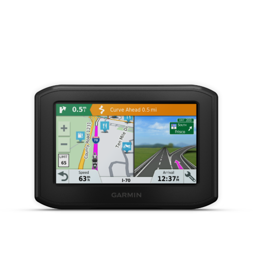 |
zumo XT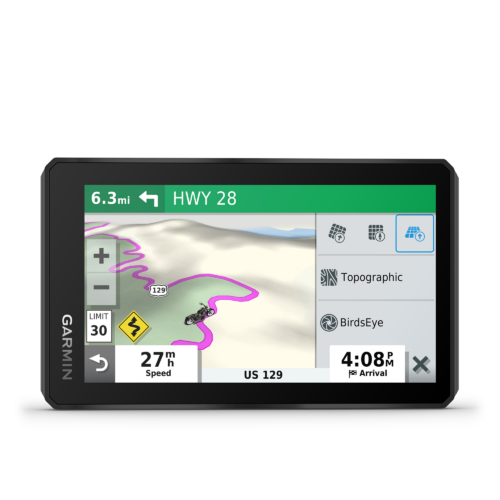 |
zumo XT2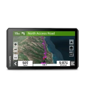 |
|
|---|---|---|---|---|
General |
||||
| Unit Dimensions | 4.94″W x 3.38″H x 0.98″D (12.5 x 8.6 x 2.5 cm) | 5.8”W x 3.5”H x 1”D (8.8 x 14.8 x 2.4 cm) |
6.15″W x 3.5″H x 1″D (15.6 x 8.9 x 2.5 cm) | 4.7": 5.04" W x 2.95" H x 0.95" D (12.8 x 7.5 x 2.4 cm) 6": 6.15" W x 3.5" H x 1" D (15.6 x 8.9 x 2.5 cm) |
| Display Size | 3.7″W x 2.2″H (9.4 x 5.6 cm); 4.3″ diag (10.9 cm) | 4.8”W x 2.7”H (12.1 x 6.8 cm); 5.5” diag (13.9 cm) | 5.3″W x 3.0″ H (13.3 x 7.5 cm); 6″ diag (15.3cm) | 4.7": 4.0" W x 2.3" H (10.3 x 5.8 cm); 4.66" diag (11.8cm) 6": 5.3" W x 3.0" H (13.3 x 7.5 cm); 6" diag (15.3cm) |
| Display Resolution | 480 x 272 pixels | 1280 x 720 pixels | 1280 x 720 pixels | 1280 x 720 pixels |
| Display Type | WQVGA color TFT with white backlight | multi-touch, glass, high brightness HD color TFT with white backlight | multi-touch, glass, high brightness HD color TFT with white backlight | multi-touch, glass, high brightness HD color TFT with white backlight |
| Dual-orientation display | ❌ | ✅ | ✅ | ✅ |
| Weight | 8.5 ounces (241.1 g) | 9.2 ounces (262 g) | 12 ounces (340 g) |
4.7": 7 oz (190 g) |
| Battery | rechargeable lithium-ion | rechargeable lithium-ion | rechargeable lithium-ion | rechargeable lithium-ion |
| Battery Life | up to 4 hours | up to 6 hours (up to 3.5 hours at 100% backlight) | up to 6 hours (up to 3.5 hours at 100% backlight) | up to 7 hours (up to 5 hours at 100% backlight) |
| Waterproof | ✅ (IPX7) | ✅ (IPX7) | ✅ (IPX7) | ✅ (IPX7) |
| Drop Rating | ❌ | MIL-STD-810 | MIL-STD-810 | MIL-STD-810 |
| Dust rating | ❌ | ❌ | ❌ | IP6X |
| High-sensitivity Receiver | ✅ | ✅(GPS/Galileo, 10 Hz multi-GNSS positioning) | ✅(GPS/Galileo, 10 Hz multi-GNSS positioning) | ✅(GPS/Galileo, 25 Hz multi-GNSS positioning) |
| Built-in WiFi for Easy Updates | ✅ | ✅ | ✅ | ✅ |
| Compatible with Group Ride Radio | ❌ | ✅ | ✅ | ✅ |
Maps & Memory |
||||
| Preloaded Maps | ✅ (City Navigator North America) | ✅ (City Navigator North America, Topographic Maps of North and Central America) | ✅ (City Navigator North America, Topographic Maps of North and Central America) | ✅ (City Navigator North America, Topographic Maps of North and Central America) |
| Includes Lifetime Map Updates | ✅ | ✅ | ✅ | ✅ |
| Downloadable Satellite Imagery | ❌ | ✅ | ✅ | ✅ |
| High Definition 3D terrain | ❌ | ❌ | ❌ | ✅ |
| 3-D Terrain View | ❌ | ✅ | ✅ | ✅ |
| 3-D Buildings and Landmarks View | ❌ | ✅ | ❌ | ❌ |
| Internal storage | 16 GB | 32 GB | 32 GB | 64 GB |
| Curvy Roads Routing | ✅ | ✅ | ✅ | ✅ |
| Ability to Add Maps | ✅ | ✅ | ✅ | ✅ |
| Custom Map Support | ✅ | ✅ | ✅ | ✅ |
| TOPO Map Support | ✅ | ✅ | ✅ | ✅ |
| Compatible with Outdoor Maps+ Subscription | ❌ | ❌ | ❌ | ✅ |
| Compatible with Garmin Explore App | ❌ | ✅ | ❌ | ❌ |
| Accepts Data Cards | microSD™ card (not included) | ✅ (4 – 256 GB max microSD™ card) | ✅ (4 – 256 GB max microSD™ card) | ✅ (256 GB max microSD™ card) |
Navigation Features |
||||
| Round Trip Routing | ✅ | ✅ | ✅ | ✅ |
| Track Support | ✅ | ✅ | ✅ | ✅ |
| Navigate-a-track navigation | ❌ | ✅ | ✅ | ✅ |
| Visual Route Planner | ❌ | ❌ | ✅ | ✅ |
| Garmin Real Directions™ landmark guidance | ✅ | ✅ | ✅ | ✅ |
| Millions of Foursquare Points of Interest | ✅ | ✅ | ❌ | ❌ |
| TripAdvisor Ratings for Travel POIs | ✅ | ✅ | ✅ | ✅ |
| Voice Prompts | ✅ | ✅ | ✅ | ✅ |
| Speaks Street Names | ✅ | ✅ | ✅ | ✅ |
| Includes Traffic | ✅ (with Smartphone Link app) | ✅ (with Garmin Drive app) | ✅(with Garmin Tread app) | ✅ (with Garmin Tread app) |
| Route shaping through preferred cities/streets | ✅ | ✅ | ✅ | ✅ |
| Tracback | ✅ | ✅ | ✅(via Tread App) | ✅ |
| Skip Waypoints | ✅ | ❌ | ✅ (via Tread App) | ✅ |
| Service History Log | ✅ | ✅ | ✅ | ❌ |
| Driver alerts for sharp curves, school zones, red light and speed camera warnings and more | ❌ | ✅ | ✅ | ✅ |
| Speed limit indicator (displays speed limit for most major roads in the U.S. and Europe) | ✅ | ✅ | ✅ | ✅ |
| Lane Assist | ✅ | ✅ | ✅ | ✅ |
| Junction View (displays Junction Signs) | ✅ | ✅ | ✅ | ✅ |
Advanced Features |
||||
| Smart Notifications Via App | ✅ | ✅ | ✅ | ✅ |
| Wi-Fi® map and software updates | ✅ | ✅ | ✅ | ✅ |
| Access to live services via app (traffic, weather, etc.) | ✅ | ✅ | ✅ | ✅ |
| Automatic Incident Detection | ✅ | ✅ | ✅ (via Tread App) | ✅(via Tread App or connected inReach device) |
| Bluetooth Wireless Technology | ✅ | ✅ | ✅ | ✅ |
| Wireless ANT+® technology | ✅ | ✅ | ✅ | ✅ |
| Smart Wireless Technology | ✅ (works with BLUETOOTH-compatible helmet, headset or smartphone (sold separately)) | ✅ (works with BLUETOOTH-compatible helmet, headset or smartphone (sold separately)) | ✅ (works with BLUETOOTH-compatible helmet, headset or smartphone. BLE capable.) | ✅ |
| Live Services Available Via App | ✅ (via Smartphone Link App ) | ✅ (via Smartphone Link App ) | ✅ (via Tread App ) | ✅ |
| LiveTrack Via Smartphone Link App | ✅ | ❌ | ❌ | ❌ |
Motorcycle Features |
||||
| Control Music and Media From Smartphones or MP3 Player | ✅ | ✅ | ✅ | ✅ |
| Built-in Spotify & Pandora Music Players | ✅ | ❌ | ❌ | ❌ |
| Sunlight readable and weather resistant | ✅ | ✅ | ✅ | ✅ |
| Garmin Adventurous Routing | ✅ | ✅ | ✅ | ✅ |
| Lean angles | ❌ | ❌ | ❌ | ✅ |
| Group Route Sharing (GPX Files) | ✅ | ✅ | ✅ | ✅ (via Tread App or via microSD card) |
| Rider Alert Warnings for Sharp Curves, State Helmet Laws, Speed Cameras and More | ✅ | ✅ | ✅ | ✅ |
| Auto Sort Multiple Destinations | ✅ | ✅ | ✅ | ✅ |
| Route Avoidance | ✅ | ✅ | ✅ (via Tread App) | ✅ |
| Helmet Law Notifications (US/CAN) | ✅ | ✅ | ✅ | ✅ |
| Planned & Dynamic Fuel Stops | ✅ | ✅ | ✅ | ✅ |
| Popular Paths (moto) | ❌ | ❌ | ✅ | ✅ |
| Ride Summary | ❌ | ❌ | ✅ | ✅ |
| Elevation profile | ✅ | ✅ | ✅ | ✅ |
| Speed Limit Indicator | ✅ | ✅ | ✅ | ✅ |
| Where am I? | ✅ | ✅ | ✅ | ✅ |
| Exit Services | ✅ | ✅ | ✅ | ✅ |
| Custom POIs | ✅ | ✅ | ✅ | ✅ |
Adventure Features |
||||
| Pair with Compatible inReach Devices | ❌ | ✅ | ✅ | ✅ |
| Pair with Garmin PowerSwitch™ digital switch box | ❌ | ✅ | ✅ | ✅ |
| Compatible with handlebar controller | ❌ | ❌ | ❌ | ✅ |
| Group Ride Mobile | ❌ | ❌ | ✅ | ✅ |
| Track Recorder (Breadcrumb) | ❌ | ✅ | ✅ | ✅ |
| Compatible with the Garmin Tread app for route planning and data management (waypoints, tracks, and routes) | ❌ | ❌ | ✅ | ✅ |
| iOverlander™ points of interest | ❌ | ✅ | ❌ | ❌ |
| Ultimate Public Campgrounds | ❌ | ✅ | ✅ | ✅ |
| BirdsEye Direct Satellite Imagery (download via Wi-Fi) | ❌ | ✅ | ✅ | ❌ |
| Glove-friendly touchscreen | ✅ | ✅ | ✅ | ✅ |
Motorsport Features |
||||
| Built-in accelerometers | ❌ | ❌ | ❌ | ✅ (with Performance Package) |
| Displays best lap time, adaptive delta time, number of laps and total session time | ❌ | ❌ | ❌ | ✅ (with Performance Package) |
| Preloaded global track database | ❌ | ❌ | ❌ | ✅ (with Performance Package) |
| Session comparisons | ❌ | ❌ | ❌ | ✅ (with Performance Package) |
| Supports multiple cars | ❌ | ❌ | ❌ | ✅ (with Performance Package) |
| Stores history of all on-track performance | ❌ | ❌ | ❌ | ✅ (with Performance Package) |
| Current weather plus 5 day forecast via Wi-Fi | ❌ | ❌ | ❌ | ✅ (with Performance Package) |
| Segment analysis (racing line, speed and acceleration/deceleration) | ❌ | ❌ | ❌ | ✅ (with Performance Package) |
| Leaderboards | ❌ | ❌ | ❌ | ✅ (with Performance Package) |
| Friend comparisons | ❌ | ❌ | ❌ | ✅ (with Performance Package) |
Posted in
Product Comparisons