
Compare GARMIN GPSMAP 64, 65, 66, 67 & H1 Series GPS
Wednesday, July 14, 2021 — 0 Comments

Garmin GPSMAP handheld navigators are excellent outdoor GPS for hiking, cycling, geocaching or climbing.You are free to explore more with Garmin handheld navigation in the palm of your hand.
Here's how the Garmin GPSMAP 60 series models are different and how to find the GPSMAP 64, 65, 66, 67 & H1 that’s best for your next outdoor adventure.
Key Differences between the Garmin GPSMAP 64, 65, 66, 67 & H1 Series
We'll look at each GPSMAP unit below but first let's look at the key differences between the GPSMAP 64, 65, 66, 67 & H1 series.
| GPSMAP H1 | GPSMAP 67 | GPSMAP 66 | GPSMAP 65 | GPSMAP 64 | |
|---|---|---|---|---|---|
| GNSS Support | GPS, Galileo, QZSS, BEIDOU and IRNSS | GPS, GLONASS (in 67), Galileo, QZSS, BEIDOU and IRNSS | GPS, GLONASS, Galileo | GPS, GLONASS, Galileo, QZSS and IRNSS | GPS, GLONASS, Galileo |
| Resolution | 282 x 470 pixels | 240 x 400 pixels | 240 x 400 pixels | 160 x 240 pixels | 160 x 240 pixels |
| Touchscreen | ✅ | ❌ | ❌ | ❌ | ❌ |
| MIL STD 810G ruggedness for thermal, shock and water performance | ✅ | ✅ | ✅ | ❌ | ❌ |
| Battery Life | Up to 145 hours in multi-band mode Up to 840 hours in expedition mode |
Up to 180 hours in default mode Up to 840 hours in expedition mode |
Up to 16 hours Up to 170 hours in expedition mode |
16 hours | 16 hours |
| RINEX Logging | ✅ | ✅ | ✅ | ❌ | ❌ |
| Bult-In Memory | 64 GB | 16 GB | 16 GB | 16 GB | 8 GB (4GB in GPSMAP 64) |
| Waypoints/ Favorites/ Locations | N/A | 10,000 | 10,000 | 5,000 | 5,000 |
| Track Log | N/A | 20,000 points, 250 saved gpx tracks, 300 saved fit activities | 20,000 points, 250 saved gpx tracks, 300 saved fit activities | 10,000 points, 200 saved tracks | 10,000 points, 200 saved tracks |
| Routes | N/A | 250 | 250 | 200 | 200 |
| Points per Route | N/A | 250 points per route; 50 points auto routing | 250, 250 points per route; 50 points auto routing | 200, 250 points per route; 50 points auto routing | 200, 250 points per route; 50 points auto routing |
| Courses | Unlimited | 250, 200 course points per course | 250, 200 course points per course | ❌ | ❌ |
| Activities | Unlimited | ✅ | ✅ | ❌ | ❌ |
| Federal Public Land Boundaries | ❌ | ❌ | in 66sr | ✅ | ❌ |
| Live Track | ✅ | ✅ | ✅ | ❌ | ❌ |
| Garmin Explore Compatible | ✅ | ✅ | ✅ | ✅ | ❌ |
| Garmin Connect IQ Compatible | ✅ | ✅ | ✅ | ❌ | ❌ |
Garmin GPSMAP 64, 65, 66, 67, H1 & H1i Plus Model Differences
- Garmin GPSMAP 66i & 67i – Send & Receive Text Messages, Share Location & Trigger SOS
- GPSMAP x, t & i Models – All have preloaded topo maps
- GPSMAP 65 & 67 Series – Routable TopoActive North America maps, Expanded GNSS Support
- GPSMAP 64, 64x & 65 – Do not have an electronic compass or barometric altimeter
Comparison of GPSMAP 64, 65, 66, 67, H1 & H1i Plus Specifications & Features
| Product | GPSMAP H1 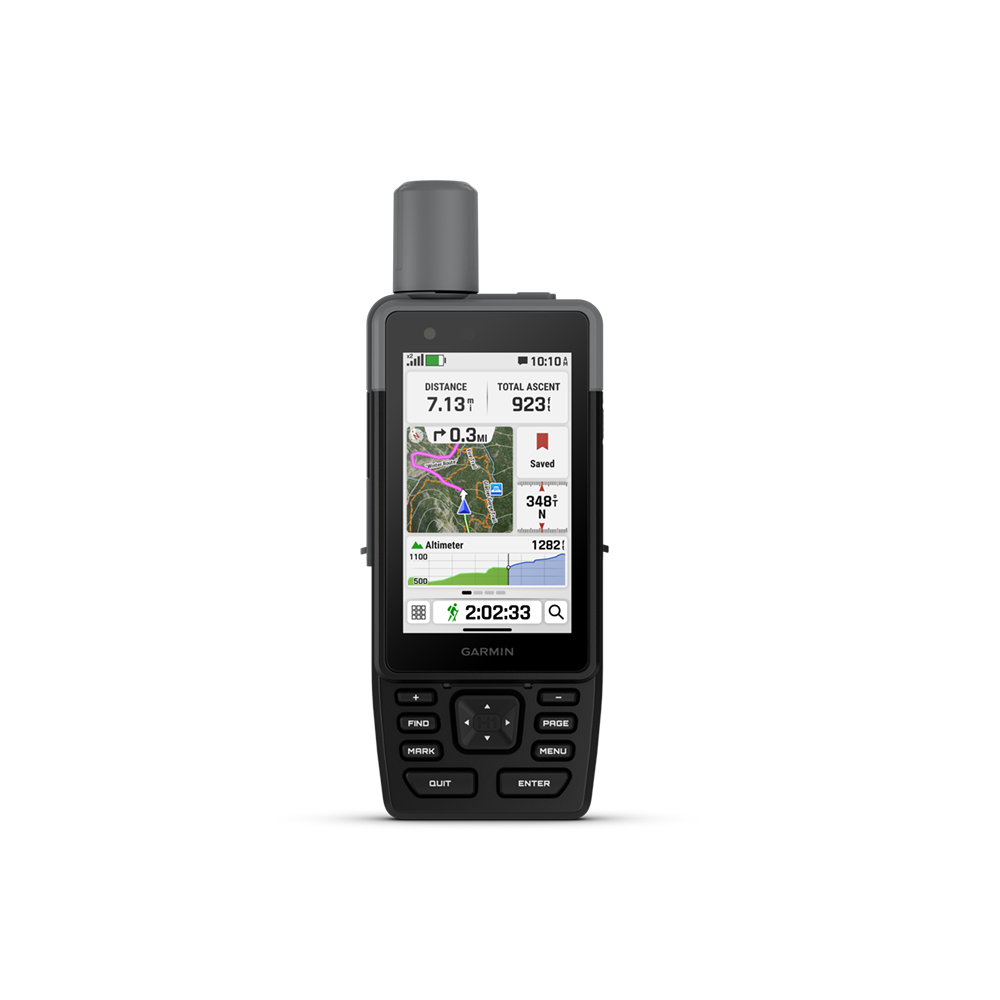 |
GPSMAP H1i Plus 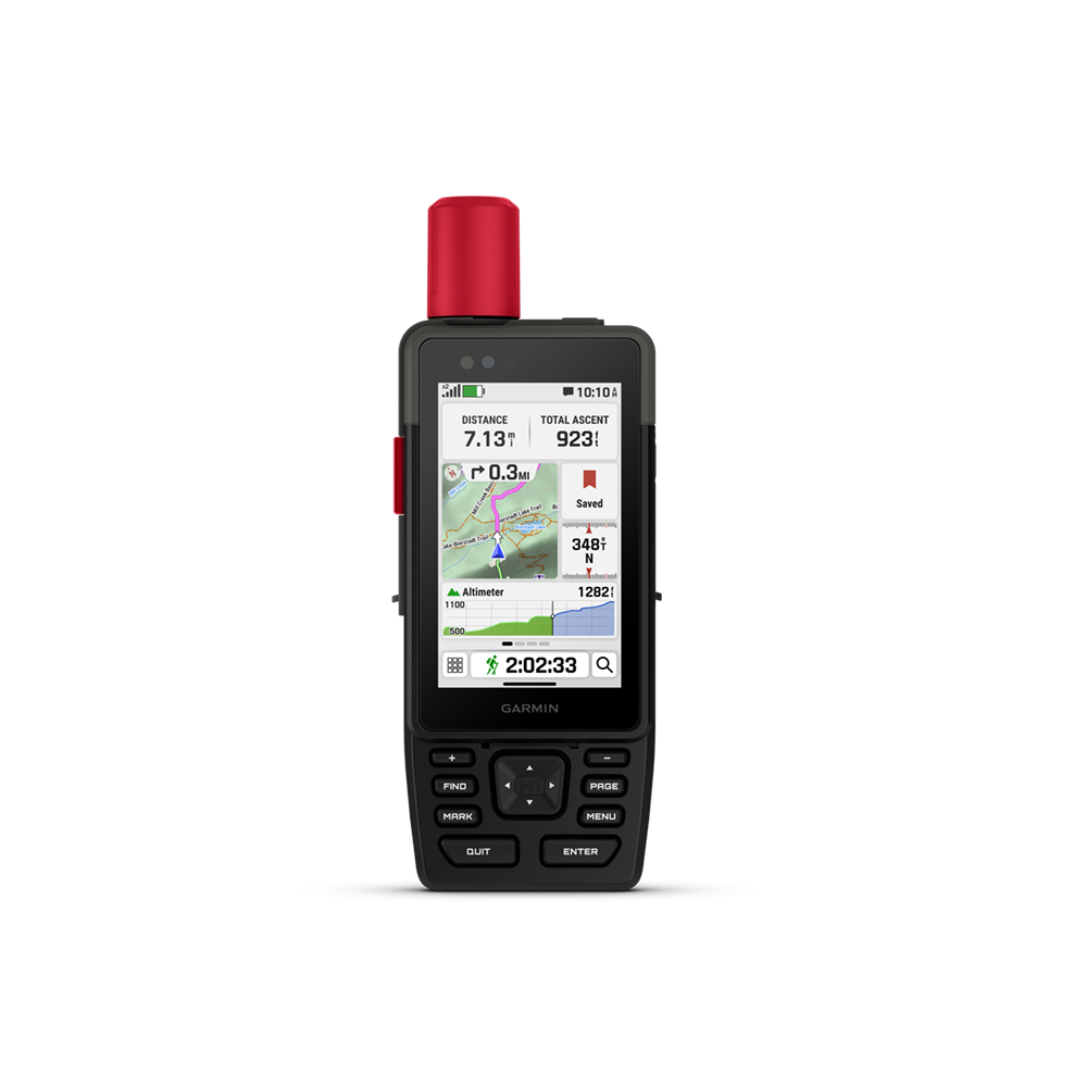 |
GPSMAP 67 |
GPSMAP 67i |
GPSMAP 66i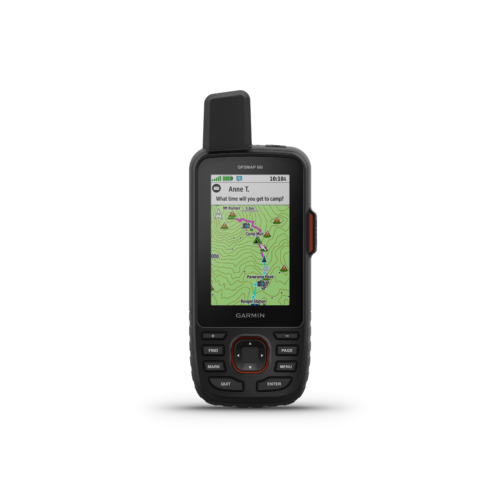 |
GPSMAP 66s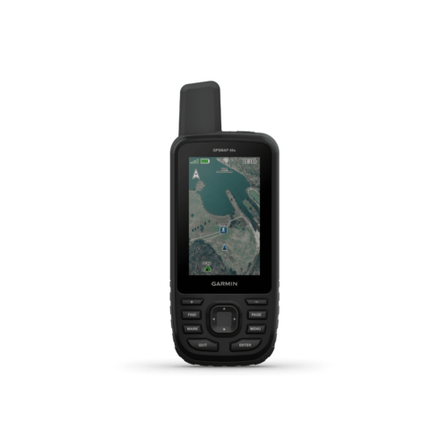 |
GPSMAP 64x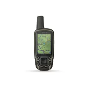 |
GPSMAP 65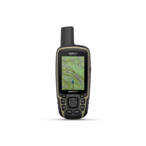 |
GPSMAP 65s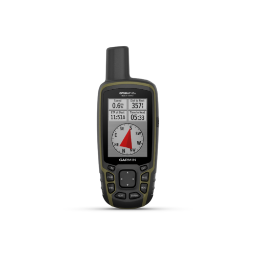 |
|---|---|---|---|---|---|---|---|---|---|
| General | |||||||||
| Unit dimensions | 2.6" x 7.0" x 1.3" (6.7 cm x 17.9 cm x 3.3cm) | 2.6" x 7.0" x 1.3" (6.7 cm x 17.9 cm x 3.3cm) | 2.5” x 6.4” x 1.4” (6.2 x 16.3 x 3.5 cm) | 2.5” x 6.4” x 1.4” (6.2 x 16.3 x 3.5 cm) | 2.6” x 6.4” x 1.4” (6.6 x 16.3 x 3.5 cm) | 2.5″ x 6.4″ x 1.4″ (6.2 x 16.3 x 3.5 cm) | 2.5″ x 6.4″ x 1.4″ (6.2 x 16.3 x 3.5 cm) | 2.5″ x 6.4″ x 1.4″ (6.2 x 16.3 x 3.5 cm) | 2.5″ x 6.4″ x 1.4″ (6.2 x 16.3 x 3.5 cm) |
| Display dimensions | 1.9"W x 3.0"H (4.7 x 7.7 cm), 3.5" diagonal (8.9 cm) | 1.9"W x 3.0"H (4.7 x 7.7 cm), 3.5" diagonal (8.9 cm) | 1.5″W x 2.5″H (3.8 x 6.3 cm); 3″ diag (7.6 cm) | 1.5″W x 2.5″H (3.8 x 6.3 cm); 3″ diag (7.6 cm) | 1.5″W x 2.5″H (3.8 x 6.3 cm); 3″ diag (7.6 cm) | 1.5″W x 2.5″H (3.8 x 6.3 cm); 3″ diag (7.6 cm) | 1.43″ x 2.15″ (3.6 x 5.5 cm); 2.6″ diag (6.6 cm) | 1.43″ x 2.15″ (3.6 x 5.5 cm); 2.6″ diag (6.6 cm) | 1.43″ x 2.15″ (3.6 x 5.5 cm); 2.6″ diag (6.6 cm) |
| Display resolution | 282 x 470 pixels | 282 x 470 pixels | 240 x 400 pixels | 240 x 400 pixels | 240 x 400 pixels | 240 x 400 pixels | 160 x 240 pixels | 160 x 240 pixels | 160 x 240 pixels |
| Display type | transflective color TFT | transflective color TFT | transflective color TFT | transflective color TFT | transflective color TFT | transflective color TFT | transflective, 65-K color TFT | transflective, 65-K color TFT | transflective, 65-K color TFT |
| Touchscreen | ✅ | ✅ | ❌ | ❌ | ❌ | ❌ | ❌ | ❌ | ❌ |
| Weight w/ batteries | 9.7 oz (276 g) | 10.2 oz (290 g) | 8.1 oz (230 g) | 8.1 oz (230 g) | 8.5 oz (241 g) | 8.1 oz (230 g) | 7.7 oz (217 g) with batteries | 7.7 oz (217 g) with batteries | 7.7 oz (217 g) with batteries |
| Battery | rechargeable, internal lithium-ion | rechargeable, internal lithium-ion | rechargeable, internal lithium-ion | rechargeable, internal lithium-ion | rechargeable, internal lithium-ion | 2 AA batteries (not included); NiMH or Lithium recommended | 2 AA batteries (not included); NiMH or Lithium recommended | 2 AA batteries (not included); NiMH or Lithium recommended | 2 AA batteries (not included); NiMH or Lithium recommended |
| Battery Life |
All Satellite Systems + Multi-band: Up to 145 hours* *Assuming typical use with SatIQ™ technology |
All Satellite Systems + Multi-band: Up to 145 hours* *Assuming typical use with SatIQ™ technology |
Up to 180 hours in default mode Up to 840 hours in expedition mode |
Up to 165 hours with inReach® enabled with 10 minute tracking Up to 180 hours in GPS Mode Up to 425 hours in Expedition mode with inReach enabled Up to 840 hours in Expedition mode |
up to 35 hours at 10-minute tracking; up to 200 hours at 30-minute tracking (power save mode) | Up to 16 hours (Standard mode) Up to 1 week (Expedition mode) |
16 hours | 16 hours | 16 hours |
| Waterproof | IP67 | IP67 | ✅ (IPX 7) | ✅ (IPX 7) | ✅ (IPX 7) | ✅ (IPX 7) | ✅ (IPX 7) | ✅ (IPX 7) | ✅ (IPX 7) |
| Interface | USB-C | USB-C | USB-C | USB-C | high-speed USB and NMEA 0183 compatible | high-speed USB and NMEA 0183 compatible | USB and NMEA 0183 compatible | high-speed USB and NMEA 0183 compatible | high-speed USB and NMEA 0183 compatible |
| MIL STD 810G ruggedness for thermal, shock and water performance | ✅ (bare unit only) | ✅ (bare unit only) | ✅ | ✅ | ✅ | ✅ | ❌ | ❌ | ❌ |
| RINEX logging | ✅ | ✅ | ✅ | ✅ | ✅ | ✅ | ❌ | ❌ | ❌ |
| LED beacon flashlight | ✅ | ✅ | ✅ | ✅ | ✅ | ✅ | ❌ | ❌ | ❌ |
| Built-in memory | 64 GB (user space varies based on included mapping) | 64 GB (user space varies based on included mapping) | 16 GB (user space varies based on included mapping) | 16 GB (user space varies based on included mapping) | 16 GB | 16 GB | 8 GB (user space varies based on included mapping) | 16 GB | 16 GB |
| Maps & Memory | |||||||||
| Basemap | ✅ | ✅ | ✅ | ✅ | ✅ | ✅ | ✅ | ✅ | ✅ |
| Preloaded maps | ✅(TopoActive, routable) | ✅(TopoActive, routable) | ✅(TopoActive, routable) | ✅(TopoActive, routable) | ✅ (TopoActive U.S and Canada; routable) | ❌ | ✅ (TopoActive U.S and Canada; routable) | ✅ (TopoActive U.S and Canada; routable) | ✅ (TopoActive U.S and Canada; routable) |
| Ability to add maps | ✅ | ✅ | ✅ | ✅ | ✅ | ✅ | ✅ | ✅ | ✅ |
| Federal public land boundaries | ❌ | ❌ | ❌ | ❌ | ❌ | ❌ | ❌ | ✅ | ✅ |
| Accepts data cards | ✅ (1 TB max microSD card) | ✅ (1 TB max microSD card) | ✅ (32 GB max microSD™ card) | ✅(32 GB max microSD™ card) | ✅ | ✅ | ✅ (32 GB max microSD™ card) | ✅ (32 GB max microSD™ card) | ✅ (32 GB max microSD™ card) |
| Waypoints | ✅ | ✅ | 10,000 | 10,000 | 10,000 | 10,000 | 5,000 | 5,000 | 5,000 |
| Courses | unlimited | unlimited | 250, 200 course points per course | 250, 200 course points per course | 250, 200 course points per course | 250, 200 course points per course | ❌ | ❌ | ❌ |
| Tracks | N/A | N/A | 250 | 250 | 250 | 250 | 200 | 200 | 200 |
| Navigation Track Log | N/A | N/A | 20,000 points, 250 saved gpx tracks, 300 saved fit activities | 20,000 points, 250 saved gpx tracks, 300 saved fit activities | 20,000 points, 250 saved gpx tracks, 300 saved fit activities | 20,000 points, 250 saved gpx tracks, 300 saved fit activities | 10,000 points, 200 saved tracks | 10,000 points, 200 saved tracks | 10,000 points, 200 saved tracks |
| Map segments | 15,000 | 15,000 | 15,000 | 15,000 | 15,000 | 15,000 | 3,000 | 3,000 | 3,000 |
| Satellite Imagery | ✅ (direct to device) | ✅ (direct to device) | ✅ (direct to device) | ✅ (direct to device) | ✅ (direct to device) | ✅ (direct to device) | ❌ | ❌ | ❌ |
| Includes detailed hydrographic features (coastlines, lake/river shorelines, wetlands and perennial and seasonal streams) | ✅ | ✅ | ✅ | ✅ | ✅ | ✅ | ✅ | ✅ | ✅ |
| Includes searchable points of interests (parks, campgrounds, scenic lookouts and picnic sites) | ✅ | ✅ | ✅ | ✅ | ✅ | ✅ | ✅ | ✅ | ✅ |
| Displays national, state and local parks, forests, and wilderness areas | ✅ | ✅ | ✅ | ✅ | ✅ | ✅ | ✅ | ✅ | ✅ |
| Activities | Unlimited | Unlimited | ✅ | ✅ | ✅ | ✅ | ❌ | ❌ | ❌ |
| Navigation Routes | N/A | N/A | 250, 250 points per route; 50 points auto routing | 250, 250 points per route; 50 points auto routing | 250 | 250, 250 points per route; 50 points auto routing | 200, 250 points per route; 50 points auto routing | 200, 250 points per route; 50 points auto routing | 200, 250 points per route; 50 points auto routing |
| Automatic Routing | ✅ | ✅ | ✅ | ✅ | ✅ | ✅ (with optional mapping for detailed roads) | ✅ | ✅ | ✅ |
| Sensors | |||||||||
| High-sensitivity receiver | ✅ GPS, GLONASS, Galileo, QZSS, BeiDou and IRNSS | ✅ GPS, GLONASS, Galileo, QZSS, BeiDou and IRNSS | ✅ GPS, GLONASS, Galileo, QZSS, BeiDou and IRNSS | ✅ GPS, Galileo, QZSS, BeiDou and IRNSS | ✅ Galileo, GLONASS & GPS | ✅ Galileo, GLONASS & GPS | ✅ Galileo, GLONASS & GPS | ✅ GPS, GLONASS, Galileo, QZSS and IRNSS | ✅ GPS, GLONASS, Galileo, QZSS and IRNSS |
| Multi-band frequency support | ✅ | ✅ | ✅ | ✅ | ❌ | ❌ | ❌ | ✅ | ✅ |
| Bluetooth/ANT+/WiFi | Bluetooth, ANT+ and WiFi | Bluetooth, ANT+ and WiFi | Bluetooth, ANT+ and WiFi | Bluetooth, ANT+ and WiFi | Bluetooth, ANT+ and WiFi | Bluetooth, ANT+ and WiFi | ❌ | Bluetooth and ANT+ | Bluetooth and ANT+ |
| Electronic Compass | ✅ (tilt-compensated, 3-axis) | ✅ (tilt-compensated, 3-axis) | ✅ (tilt-compensated, 3-axis) | ✅ (tilt-compensated, 3-axis) | ✅ (tilt-compensated, 3-axis) | ✅ (tilt-compensated, 3-axis) | ❌ | ❌ | ✅ (tilt-compensated, 3-axis) |
| Barometric altimeter | ✅ | ✅ | ✅ | ✅ | ✅ | ✅ | ❌ | ❌ | ✅ |
| Outdoor Recreation | |||||||||
| Point-to-point navigation | ✅ | ✅ | ✅ | ✅ | ✅ | ✅ | ✅ | ✅ | ✅ |
| Spoken turn-by-turn directions | ✅ | ✅ | ❌ | ❌ | ❌ | ❌ | ❌ | ❌ | ❌ |
| TracBack® | ✅ | ✅ | ✅ | ✅ | ✅ | ✅ | ❌ | ❌ | ❌ |
| Picture viewer | ✅ | ✅ | ✅ | ✅ | ✅ | ✅ | ✅ | ✅ | ✅ |
| Camera | ❌ | Front: 5 MP Rear: 8 MP |
❌ | ❌ | ❌ | ❌ | ❌ | ❌ | ❌ |
| Custom map compatible | ✅ (500 custom map tiles) | ✅ (500 custom map tiles) | ✅ (500 custom map tiles) | ✅ (500 custom map tiles) | ✅ (500 custom map tiles) | ✅ (500 custom map tiles) | ✅ (500 custom map tiles) | ✅ (500 custom map tiles) | ✅ (500 custom map tiles) |
| BirdsEye satellite Imagery Compatible | ✅ (direct to device) | ✅ (direct to device) | BirdsEye Direct to device (no annual subscription required) | BirdsEye Direct to device (no annual subscription required) | BirdsEye Direct to device (no annual subscription required) | BirdsEye Direct to device (no annual subscription required) | ❌ | ❌ | ❌ |
| Geocaching-friendly | ✅ (Geocaching Live) | ✅ (Geocaching Live) | ✅ (Geocaching Live) | ✅ (Geocaching Live) | ✅ (Geocaching Live) | ✅ (Geocaching Live) | ✅ (Paperless) | ✅ (Paperless) | ✅ (Paperless) |
| Hunt/Fish calendar | ❌ | ❌ | ✅ | ✅ | ✅ | ✅ | ✅ | ✅ | ✅ |
| Sun and moon information | ✅ | ✅ | ✅ | ✅ | ✅ | ✅ | ✅ | ✅ | ✅ |
| Area calculations | ✅ | ✅ | ✅ | ✅ | ✅ | ✅ | ✅ | ✅ | ✅ |
| Custom POIs | ✅ | ✅ | ✅ | ✅ | ✅ | ✅ | ✅ | ✅ | ✅ |
| Tactical Features | |||||||||
| Compatible with AB Quantam - Garmin | ✅ | ✅ | ❌ | ❌ | ❌ | ❌ | ❌ | ❌ | ❌ |
| Ballistics solver | ✅ (unlock required) | ✅ (unlock required) | ✅ (unlock required) | ✅ (unlock required) | ❌ | ❌ | ❌ | ❌ | ❌ |
| Dual grid coordinates | ✅ | ✅ | ❌ | ❌ | ❌ | ❌ | ❌ | ❌ | ❌ |
| Night vision mode | ✅ | ✅ | ❌ | ❌ | ❌ | ❌ | ❌ | ❌ | ❌ |
| Xero Locations | ❌ | ❌ | ✅ | ✅ | ✅ | ✅ | ❌ | ❌ | ❌ |
| Daily Smart Features | |||||||||
| Smart Notifications | ✅ | ✅ | ✅ | ✅ | ✅ | ✅ | ❌ | ✅ | ✅ |
| Live Tracking | ✅ | ✅ | ✅ | ✅ | ✅ | ✅ | ❌ | ❌ | ❌ |
| Safety siren | ✅ | ✅ | ❌ | ❌ | ❌ | ❌ | ❌ | ❌ | ❌ |
| Garmin Connect compatible | ✅ | ✅ | ✅ | ✅ | ✅ | ✅ | ✅ | ✅ | ✅ |
| Garmin Explore compatible | ✅ | ✅ | ✅ | ✅ | ✅ | ✅ | ❌ | ✅ | ✅ |
| Garmin connect IQ compatible | ✅ | ✅ | ✅ | ✅ | ✅ | ✅ | ❌ | ❌ | ❌ |
| Compatible with Garmin Messenger app | ❌ | ✅ | ❌ | ✅ | ❌ | ❌ | ❌ | ❌ | ❌ |
| Smart switching between Wi-Fi, Cellular and Satellite with Garmin Messenger app | ❌ | ✅ | ❌ | ✅ | ❌ | ❌ | ❌ | ❌ | ❌ |
| Voice command | ❌ | ✅ | ❌ | ❌ | ❌ | ❌ | ❌ | ❌ | ❌ |
| Noise cancellation | ❌ | ✅ | ❌ | ❌ | ❌ | ❌ | ❌ | ❌ | ❌ |
| Voice assistant | ❌ | ✅ | ❌ | ❌ | ❌ | ❌ | ❌ | ❌ | ❌ |
| Voice notes | ❌ | ✅ | ❌ | ❌ | ❌ | ❌ | ❌ | ❌ | ❌ |
| Passcode | ✅ | ✅ | ❌ | ❌ | ❌ | ❌ | ❌ | ❌ | ❌ |
| Garmin Share | ✅ | ✅ | ❌ | ❌ | ❌ | ❌ | ❌ | ❌ | ❌ |
| Auto correct keyboard | ✅ | ✅ | ❌ | ❌ | ❌ | ❌ | ❌ | ❌ | ❌ |
| inReach remote widget | ✅ | built in inReach capabilities | ❌ | built in inReach capabilities | built in inReach capabilities | ✅ | ❌ | ❌ | ❌ |
| inReach Features | |||||||||
| Interactive SOS | ❌ | ✅ | ❌ | ✅ | ✅ | ❌ | ❌ | ❌ | ❌ |
| inReach weather | ❌ | ✅ | ❌ | ✅ | ✅ | ❌ | ❌ | ❌ | ❌ |
| Send and receive text messages to SMS and email | ❌ | ✅ | ❌ | ✅ | ✅ | ❌ | ❌ | ❌ | ❌ |
| Send and receive text messages to other inReach device | ❌ | ✅ | ❌ | ✅ | ✅ | ❌ | ❌ | ❌ | ❌ |
| Send and receive group messages | ❌ | ✅ | ❌ | ✅ | ✅ | ❌ | ❌ | ❌ | ❌ |
| Send and receive photos | ❌ | ✅ | ❌ | ❌ | ❌ | ❌ | ❌ | ❌ | ❌ |
| Send and receive voice messages | ❌ | ✅ | ❌ | ❌ | ❌ | ❌ | ❌ | ❌ | ❌ |
| Send and receive 1,600 character messages | ❌ | ✅ | ❌ | ❌ | ❌ | ❌ | ❌ | ❌ | ❌ |
| Exchange locations with other inReach device | ❌ | ✅ | ❌ | ✅ | ✅ | ❌ | ❌ | ❌ | ❌ |
| Wikiloc (Preloaded with the Wikiloc app with risk-free trial offering more than 9 million trails for download) | ❌ | ❌ | ❌ | ❌ | ✅ | ❌ | ❌ | ❌ | ❌ |
| MapShare compatible with tracking | ❌ | ✅ | ❌ | ✅ | ✅ | ❌ | ❌ | ❌ | ❌ |
| Virtual keyboard for custom messaging | ❌ | ✅ | ❌ | ✅ | ✅ | ❌ | ❌ | ❌ | ❌ |
| Send waypoints to MapShare during trip | ❌ | ✅ | ❌ | ✅ | ✅ | ❌ | ❌ | ❌ | ❌ |
| Send route selection to MapShare during trip | ❌ | ✅ | ❌ | ✅ | ✅ | ❌ | ❌ | ❌ | ❌ |
| inReach remote compatible | ✅ | ❌ | ✅ | ❌ | ❌ | ❌ | ❌ | ❌ | ❌ |
Garmin GPSMAP 64, 65, 66 & 67 FAQs
I like the 66sr but the internal battery worries me. What gps is equivalent with replaceable batteries without losing water proof features and shock resistance ?
The closest unit to the 66SR that would take AA batteries would be the Garmin GPSMAP 65S this unit will have the advanced GPS receiver and the capabilities of doing GNSS.