
GARMIN GPSMAP 78, 79 & 86 Series GPS Comparison
Written by GPS Central
Thursday, July 8, 2021 — 0 Comments
Thursday, July 8, 2021 — 0 Comments
Garmin GPSMAP 78, 79 & 86 series handheld GPS units are reliable and portable GPS devices that are suitable for hiking, hunting, ATV-ing or any outdoor adventure.
Some of the key differences between the units in the GPSMAP 78 & 86 series include:
- Internal batteries: the GPSMAP 86 series has an internal rechargeable battery whereas the GPSMAP 78 requires two AA batteries.
- Pre-loaded maps: The “sc” units (GPSMAP 86sc & 86sci) have preloaded BlueChart g3 U.S. coastal charts, the other units have no preloaded maps. All units have the ability to add maps.
- Internal memory: The GPSMAP 78 series has a much smaller internal memory (1.7GB) than the GPSMAP 86 series (16GB). This impacts how many routes, waypoints and tracklogs you can store.
- Photo navigation: The GPSMAP 78 series allows you to navigate to places where you’ve taken photos, the GPSMAP 86 series does not.
Some of the key differences between the units in the GPSMAP 78 & 79 series include:
- Update Display: New scratch-resistant, bonded display provides improved contrast and eliminates fogging; 26% larger screen with 2.5 times the resolution of the past generation in a sunlight-visible color display
- GNSS: Reliable single-band GNSS supports multiple constellations (GPS, GLONASS, Beidou, Galileo, QZSS and SBAS) to allow for access to data around the world
- Cartography: Built-in BlueChart® g3 charts (sc model only)
- Memory: Ability to track 10,000 waypoints (versus 2,000 in GPSMAP 78) and 250 routes (versus 200 in GPSMAP 78), 300 saved fitness activities, 8GB of internal memory (versus 1.7GB in GPSMAP 78s/sc)
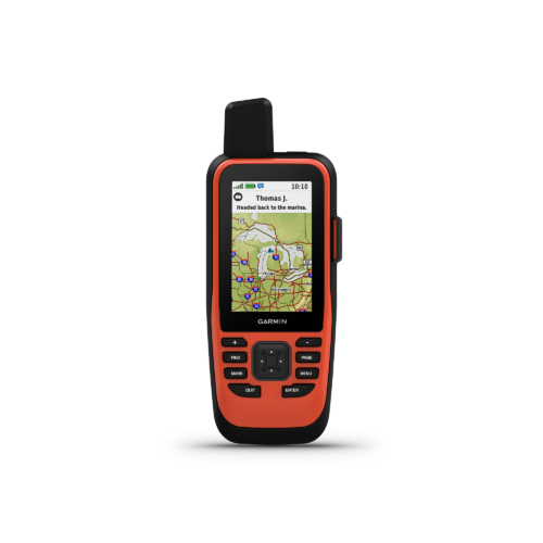
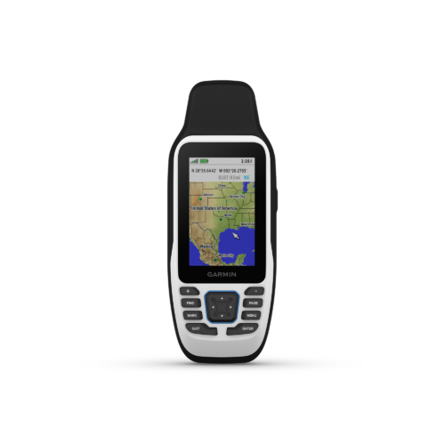
| Product | GPSMAP 86s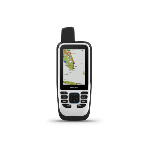 |
|
|
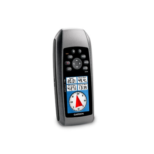
GPSMAP 78/s/sc
|
|
|---|---|---|---|---|---|
| General | |||||
|
Unit Dimensions |
2.65″ x 7″ x 1.7″ (6.75 x 17.8 x 4.4 cm) | 2.75″ x 7″ x 1.7″ (7 x 17.8 x 4.4 cm) | 2.75″ x 7″ x 1.7″ (7 x 17.8 x 4.4 cm) | 2.6″ x 6.0″ x 1.2″ (6.6 x 15.2 x 3.0 cm) |
2.67” x 6.85” x 1.67” (6.77 x 17.40 x 4.23 cm) |
| Weight | 9.59 oz (272 g) | 9.59 oz (272 g) | 9.59 oz (272 g) | 7.7 oz (218.3 g) with batteries | 9.95 oz (282g) with batteries |
| Water rating | IPX7 | IPX7 | IPX7 | IPX7 | IPX7 |
| MIL-STD-810 | ✅ (thermal, shock, water) | ✅ (thermal, shock, water) | ✅ (thermal, shock, water) | ❌ | ✅ (thermal, shock, water); bare unit only |
| Display Type | transflective, 65K color TFT | transflective, 65K color TFT | transflective, 65K color TFT | transflective, 65K color TFT | transflective, 65K color TFT |
| Display Size | 1.5"W x 2.5"H (3.8 x 6.3 cm); 3" diag (7.6 cm) | 1.5"W x 2.5"H (3.8 x 6.3 cm); 3" diag (7.6 cm) | 1.5"W x 2.5"H (3.8 x 6.3 cm); 3" diag (7.6 cm) | 1.43" x 2.15" (3.6 x 5.5 cm); 2.6" diag (6.6 cm) | 1.5"W x 2.5"H (3.8 x 6.3 cm); 3" diag (7.6 cm) |
| Display Resolution | 240 x 400 pixels | 240 x 400 pixels | 240 x 400 pixels | 160 x 240 pixels | 240 x 400 pixels |
| Battery type | rechargeable, internal lithium-ion | rechargeable, internal lithium-ion | rechargeable, internal lithium-ion | 2 AA batteries (not included); NiMH or Lithium recommended | 2 AA batteries (not included); NiMH or Lithium recommended |
| Battery life | up to 35 hours at 10-minute tracking; up to 200 hours at 30-minute tracking (power save mode) | up to 35 hours at 10-minute tracking; up to 200 hours at 30-minute tracking (power save mode) | up to 35 hours at 10-minute tracking; up to 200 hours at 30-minute tracking (power save mode) | 20 hours | up to 19 hours |
| Memory/History | 16 GB (user space varies based on included mapping) | 16 GB (user space varies based on included mapping) | 16 GB (user space varies based on included mapping) | 1.7 GB | 8 GB (user space varies based on included mapping on sc version) |
| Interface | high speed microUSB and NMEA 0183 compatible | high speed microUSB and NMEA 0183 compatible | high speed microUSB and NMEA 0183 compatible | high speed microUSB and NMEA 0183 compatible | |
| Maps & Memory | |||||
| Preloaded maps | ❌ | ❌ | ✅(BlueChart® g3 included) | ❌ | Available on sc version only |
| Ability to add maps | ✅ | ✅ | ✅ | ✅ | ✅ |
| Basemap | ✅ | ✅ | ✅ | ✅ | ✅ |
| Automatic routing (turn by turn routing on roads) for outdoor activities | ❌ | ❌ | ❌ | ✅ (with optional mapping for detailed roads) | ✅ (with optional mapping for detailed roads) |
| Map segments | 15,000 | 15,000 | 15,000 | N/A | 15,000 |
| Satellite Imagery | ✅(direct to device) | ✅(direct to device) | ✅(direct to device) | ❌ | ❌ |
| Includes detailed hydrographic features (coastlines, lake/river shorelines, wetlands and perennial and seasonal streams) | ❌ | ❌ | ❌ | ❌ | ✅ (downloadable from Garmin Express™) |
| Includes searchable points of interests (parks, campgrounds, scenic lookouts and picnic sites) | ✅ (downloadable from Garmin Express™) | ✅ (downloadable from Garmin Express™) | ✅ (downloadable from Garmin Express™) | ❌ | ✅ (downloadable from Garmin Express™) |
| Displays national, state and local parks, forests, and wilderness areas | ✅ (downloadable from Garmin Express™) | ✅ (downloadable from Garmin Express™) | ✅ (downloadable from Garmin Express™) | ❌ | ✅ (downloadable from Garmin Express™) |
| External memory storage | ✅ (32 GB max microSD™ card, not included) | ✅ (32 GB max microSD™ card, not included) | ✅ (32 GB max microSD™ card, not included) | ✅ (microSD™ card, not included) | ✅ (32 GB max microSD™ card, not included) |
| Waypoints/favorites/locations | 10,000 | 10,000 | 10,000 | 2,0000 | 10,000 |
| Courses | 250, 200 course points per course | 250, 200 course points per course | 250, 200 course points per course | ❌ | 250, 200 course points per course |
| Tracks | 250 | 250 | 250 | 200 | 250 |
| Navigation Track Log | 20,000 points, 250 saved gpx tracks, 300 saved fit activities | 20,000 points, 250 saved gpx tracks, 300 saved fit activities | 20,000 points, 250 saved gpx tracks, 300 saved fit activities | 10,000 points, 200 saved tracks | 20,000 points, 250 saved gpx tracks, 300 saved fit activities |
| Activities | ✅ | ✅ | ✅ | ❌ | ❌ |
| Navigation Routes | 250, 250 points per route; 50 points auto routing | 250, 250 points per route; 50 points auto routing | 250, 250 points per route; 50 points auto routing | 250, 250 points per route; 50 points auto routing | |
| Rinex logging | ✅ | ✅ | ✅ | ❌ | ✅ |
| Sensors | |||||
| GPS/GLONASS/Galileo/QZSS/SBAS | GPS/GLONASS/Galileo | GPS/Galileo | GPS/Galileo | GPS | GPS/Galileo/QZSS/SBAS |
| Barometric altimeter | ✅ | ✅ | ✅ | ✅ | ❌ |
| Compass | ✅ (tilt-compensated 3-axis) | ✅ (tilt-compensated 3-axis) | ✅ (tilt-compensated 3-axis) | ✅ (tilt-compensated 3-axis) | ✅ (tilt-compensated 3-axis) |
| High-sensitivity receiver | ✅ | ✅ | ✅ | ✅ | ✅ |
| GPS compass (while moving) | ✅ | ✅ | ✅ | ❌ | ✅ |
| Daily Smart Features | |||||
| Connect IQ™ (downloadable watch faces, data fields and apps) | ✅ | ✅ | ✅ | ❌ | ❌ |
| Smart notifications on handheld | ✅ | ✅ | ✅ | ❌ | ❌ |
| Weather forecasts | ✅ | ✅ | ✅ | ❌ | ❌ |
| Weather | ✅ | ✅ | ✅ | ❌ | ❌ |
| Compatible with Garmin Messenger app | ✅ | ✅ | ❌ | ❌ | |
| VIRB® Remote | ✅ | ✅ | ✅ | ❌ | ❌ |
| Pairs with Garmin Connect™ Mobile | ✅ | ✅ | ✅ | ❌ | ❌ |
| LiveTrack | ✅ | ✅ | ✅ | ❌ | ❌ |
| Outdoor Recreation | |||||
| XERO™ Locations | ✅ | ✅ | ✅ | ❌ | ❌ |
| Point-to-point navigation | ✅ | ✅ | ✅ | ❌ | ✅ |
| TracBack® | ✅ | ✅ | ✅ | ❌ | ❌ |
| Area calculation | ✅ | ✅ | ✅ | ✅ | ✅ |
| Fish forecast | ✅ | ✅ | ✅ | ✅ | ✅ |
| Sun and moon information | ✅ | ✅ | ✅ | ✅ | ❌ |
| Geocaching-friendly | ✅(Geocache Live) | ✅(Geocache Live) | ✅(Geocache Live) | ✅(Paperless) | ✅(Paperless) |
| Custom maps compatible | ✅(500 custom map tiles) | ✅(500 custom map tiles) | ✅(500 custom map tiles) | ✅ | ✅ |
| Picture viewer | ✅ | ✅ | ✅ | ✅ | ✅ |
| LED beacon flashlight | ✅ | ✅ | ✅ | ❌ | ❌ |
| inReach Features | |||||
| Interactive SOS | ❌ | ✅ | ✅ | ❌ | ❌ |
| Weather | ❌ | ✅ | ✅ | ❌ | ❌ |
| Send and receive text messages to SMS and email | ❌ | ✅ | ✅ | ❌ | ❌ |
| Send and receive text messages to other inReach device | ❌ | ✅ | ✅ | ❌ | ❌ |
| Send and receive group messages | ❌ | ✅ | ✅ | ❌ | ❌ |
| Exchange locations with other inReach device | ❌ | ✅ | ✅ | ❌ | ❌ |
| MapShare compatible with tracking | ❌ | ✅ | ✅ | ❌ | ❌ |
| Virtual keyboard for custom messaging | ❌ | ✅ | ✅ | ❌ | ❌ |
| Send waypoints to MapShare during trip | ❌ | ✅ | ✅ | ❌ | ❌ |
| Send route selection to MapShare during trip | ❌ | ✅ | ✅ | ❌ | ❌ |
| inReach remote compatible | ✅ | ✅ | ✅ | ❌ | ❌ |
| Outdoor Applications | |||||
| Compatible with Garmin Explore™ app | ✅ | ✅ | ✅ | ❌ | ❌ |
| Garmin Explore website compatible | ✅ | ✅ | ✅ | ❌ | ❌ |
| Smart switching between Wi-Fi, Cellular and Satellite with Garmin Messenger app | ❌ | ✅ | ✅ | ❌ | ❌ |
| Wireless Connectivity | Wi-Fi®, BLUETOOTH®, ANT+® | Wi-Fi®, BLUETOOTH®, ANT+® | Wi-Fi®, BLUETOOTH®, ANT+® | N/A | N/A |

Posted in
Product Comparisons